Today we visit the seafront of Rianxo.
The seafront is almost 2 kilometers long. It connects the urban center of Rianxo from the Port of Setefogas to A Torre beach in the neighboring parish of Taragoña. The walk offers views of the Ensenada de Rianxo in the Ria de Arousa and the Sierra del Barbanza. Before reaching A Torre Beach we will see O Pazo beach, the Castelo da Lúa (“Castle of the Moon”) and the mouth of the River Te.
Coordinates to find the location of Rianxo in Galicia. Extend the map and reach Setefogas: 42.653630, -8.818107

The municipality of Rianxo is located to the south of the province of A Coruña, in the Ría de Arousa and the Ulla River Estuary. It has a population of about 11500 inhabitants.
It has a great relationship with the sea through its port especially with the mussel cultivation and cockle shell fishing, for the canning industry. There are also riverside shipyards dedicated to the maintenance and repair of fishing boats.
The attractions of Rianxo its beaches, viewpoints and its religious and civil heritage, help to make the tourist sector to be on the rise too.
Also it is known for being the birthplace of important writers, especially in the Galician language, as Castelao, Rafael Dieste, Manuel Antonio and Brea Segade.
The Port of Setefogas has a curved shape and not in a straight line as usual.


We start the walk along the seafront. We see a xeiteira. The dornas or xeiteiras boats are traditional vessels engaged in artisanal fishing. This is a replica made by students of the Workshop School of Rianxo.


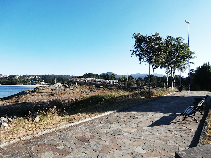
We have left far behind the Port of Setefogas, to the left of the picture.

Few meters further on we see in the background of the picture the beaches of A Torre in the center and O Pazo to the right.


We are approaching the beach O Pazo.


O Pazo beach.

View of the Ensenada de Rianxo in the Ría de Arousa. (https://en.wikipedia.org/wiki/Ría_de_Arousa).

We see from O Pazo beach the part of the seafront that we have already walked from Setefogas.


A few steps further on and we find this viewpoint.


Now we see to the left of the picture A Torre beach also the ruins of the Castelo da Lua (“the Castle of the Moon”) and the wooden walkway that leads to the footbridge over the mouth of the River Te.
These are the wooden walkway, the footbridge and the ruins of the Castelo da Lúa to the left.

We continue walking by the walkway…

The castle was probably built in the thirteenth century, being demolished and rebuilt several times. In 2001 archaeological excavations were made directed by A. Bonilla. It was concluded that the castle had a rectangular plan and an outer wall with a moat and it had a tower and two side bastions.
Leaning on the railing of the walkway we see the ruins of the castle.

Now we can see A Torre beach.

The footbridge.

The wooden walkway.


We can see now A Torre beach from the footbridge.


After crossing the footbridge we see the river Te and at its mouth.


We descended a small slope towards A Torre beach.


A Torre beach.


Behind this little wooden fence at low tide you can continue the walk almost 800 more meters. The part of the beach demarcated by wooden fences is about 200 meters long.


The End.
No comments:
Post a Comment