We visit today the village of Maceda in Ourense. Welcome to the Castle of Maceda.
We will stroll around the castle and go to the inside to walk the wall.
Later we will see the interior rooms, the Patio de Armas (parade ground) and the rooms dedicated to the hotel and restaurant activity.

Coordinates to find the location of Maceda in Galicia. Extend the map and reach the Castle of Maceda: 42.270525, -7.658932
Arrival at the castle. It is situated less than one kilometre from the centre of Maceda, in a strategic location overlooking the Valley of Maceda and the Mountain range of San Mamede.


We borrowed this plan of the castle from: http://proxectoarga.com/Architecture/Building/33 Here the design and execution of restoration of the castle are explained. It was directed by the architect Manuel Seoane Feijoo within the Proyecto ARGA.

This is a cobblestone ascent for vehicle access. As we have indicated, before entering the castle we go for a walk around it.

Maceda is a municipality located in the center of Ourense Province. It has about 3000 inhabitants. It is situated in an area of outstanding natural wealth and heritage.

The castle began to be built in the late 11th century. It has come to our days after eventful historical ups and downs in state of neglect and ruin.

It was declared Monumento Histórico Artístico (Historical-Artistic Monument) by Decree of April 22, 1949.

In 1996 the municipality of Maceda purchased it to its owners to develop a significant recovery and restoration project, with the support of the Xunta de Galicia (https://en.wikipedia.org/wiki/Xunta_de_Galicia). Today the castle houses a hotel and restaurant which is located in a natural environment of great beauty.

Some scholars argue that King Alfonso X El Sabio (https://en.wikipedia.org/wiki/Alfonso_X_of_Castile) spent part of his childhood here and here he learned the Galician language (https://en.wikipedia.org/wiki/Cantigas_de_Santa_Maria).


We have been walking along the cobblestone road that surrounds the castle.


This is the Coat of arms of lineage of the Novoa to which the castle belonged for a long period of its history. It represents the spread eagle in the lower part and the towers on the top.


This is the tower with a square floor plan.


This is the part of the wall that we saw when arriving with the cobblestone ascent for vehicle access.


Coat of Arms with thirteen roundels (https://en.wikipedia.org/wiki/Roundel_(heraldry)), it is the emblem of Sarmiento lineage.

This is the entrance door to the castle. It has a round arch.


Coats of arms and an arrowslit (https://en.wikipedia.org/wiki/Arrowslit).

The Coat of arms we can see to the left of the picture represents the spread eagle and the towers of the Novoa lineage to which the castle belonged for a long period of its history.
The coat of arms on the right has four quarters (https://en.wikipedia.org/wiki/Quartering_(heraldry)) divided by the cross of lineage of the Rivadeneira.
In the four quarters it represents the emblems of another four lineages such as Sarmiento (thirteen roundels (https://en.wikipedia.org/wiki/Roundel_(heraldry)), Ulloa (four bars), Mendoza (the Ave Maria Gratia Plena) and Castro (six roundels).

We are right beneath the arch of the entrance door to the castle. We can climb to the wall up the stairs we see to the left.

Or else go to the inside of the castle and its rooms dedicated to hotel.

We now enter the castle. We pass the glass door, climb some stairs and continue along a corridor. From here we can go to the left towards the part dedicated to the hotel or go to the outside again to start our walk through the wall. In the center of the picture we can see the Patio de Armas (parade ground) in which we will be later.

These stairs lead us to the wall. To the left the Keep (https://en.wikipedia.org/wiki/Keep), the oldest part of the castle which was built first, in the 11th century.


We begin here the walk along the wall.

We are now in this corner of the wall.

From the same place.
We continue walking by the next part of the wall. To the right of the picture we see the battlements of the wall.

We approach the next corner of the wall in which there is a tower having a circular floor plan.


From this same place we look to our back.

We are now in the circular tower.

Another loophole (https://en.wikipedia.org/wiki/Arrowslit), located in the tower.

This is the next section we will walk seen from the circular tower.

We walk along the next stretch of the wall.

This is the window which we will see later when we visit the Parade Ground of the castle.

We reach the next corner of the wall.

From here we look to the last section that we have just walk…

And toward the last that we are about to go. At the background of the picture we see the top of the defensive square tower in which the hotel cafe is located. The views as we will see are magnificent.

We are approaching the tower.

These are the stairs that we saw to the left of the entrance door to the castle. Now we see from here the last stretch of the wall. Go to the inside again.

By the same corridor through which we entered the castle before now we turn left.

We go out to the parade ground.

The three stone columns highlight and the well, drilled in the rock.


Climbing the wooden stairs there is in the Patio de Armas we get here. We can see the parladoiros which are stone seats there are in the windows, the inhabitants of the Castle sat to talk and look out the window. (https://en.wikipedia.org/wiki/Window_seat_(type_of_sofa)).

What is seen behind bars is the Church of San Pedro de Maceda which is located less than 200 metres from the castle.

We are now in the hotel reception. This loophole shows us how thick the interior walls of the castle are. They are thicker than other castles in Europe.

We are going to enter the restaurant. Sometime this wall was an outer wall because of the existence of this other loophole which as we know had a defensive function.


The restaurant is located in the Keep (https://en.wikipedia.org/wiki/Keep), as we have mentioned the oldest part of the castle which was built first, in the 11th century.

This part of the restaurant overlooks the parade ground. Here there are also parladoiros.


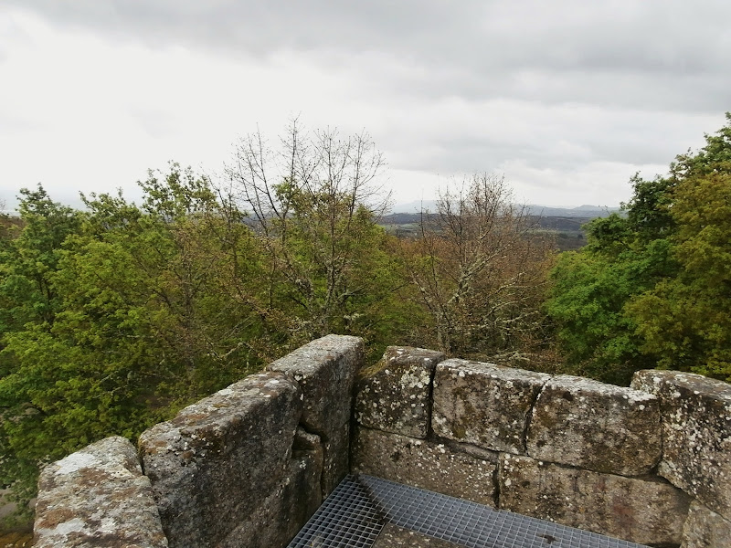
We go outside again this time beside the café of the hotel. We see these views of the Valley of Maceda and in the background the Mountain range of San Mamede.

Now we approach the top of the square tower.
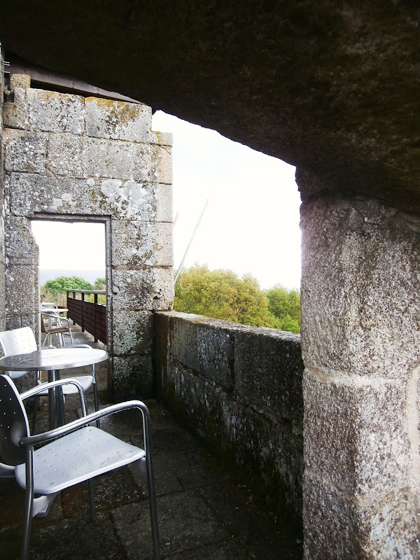
The terrace of the cafe is located here.


It is time to end the visit. One last view to the landscape.

The Mountain Range of San Mamede is barely visible behind that spring shower.

The End.
No comments:
Post a Comment