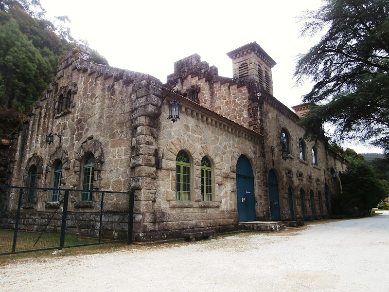
Today we visit the municipality of Noia in the province of A Coruña, it also gives name to the Ría de Muros y Noia. We will see the Tambre Hydroelectric Power Plant, the imposing building designed by the architect Antonio Palacios and built in 1932. Also we will walk along the pedestrian walkway beside the River Tambre, the suspension bridge and the old medieval pesqueiras for lamprey fishing.
Coordinates to find the location of Noia in Galicia. Extend the map and reach Tambre Hydroelectric Power Plant: 42.836400, -8.849661

Noia has 15,000 inhabitants. As the capital of region trade is one of the traditional economic pillars of the municipality. We must also bear in mind the sector of shell fishing, cockles and clams (fina and babosa species), with its production centered in the port area of Testal. Like all the beautiful municipalities in the area tourism is increasing its activity every year, especially in the summer months.
Visitors can enjoy a rich religious and civil heritage. The municipality offers a wide variety of pazos (https://en.wikipedia.org/wiki/Pazo), churches and bridges of different historical periods. Not forgetting the privileged natural areas and beaches.
Now we begin the visit.
View of Hydroelectric Power Plant called Tambre II. It is very close to the one built by the architect Antonio Palacios (the Hydroelectric Power Plant Tambre I, the purpose of our visit). We also can see the River Tambre.

This is the huge pipe through which water flows down for electricity production in the Tambre II plant.

The two dams, Tambre I and Tambre II, are gravity dams. In the case of the Tambre I plant water flows through a canal parallel to the course of the river Tambre from the Barrié de la Maza reservoir which is located seven kilometres upstream.
In the case of Tambre II plant water also flows from the reservoir through a gallery of 4.40 metres in diameter. When the canal and the gallery reach the environs of the two plants water is led into these large pipe sizes. We can see the steep slope of the land in here.
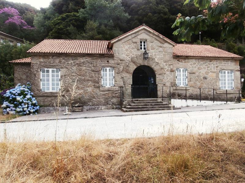
We are now in the facilities of the Hydroelectric Power Plant Tambre I. There is a fishing reserve here. The River Tambre is influenced by tides. From here to its mouth the river runs approximately 5 kilometers.


Besides the main building a number of additional buildings were constructed. They were la casa del jefe (the house of the head, where the director was staying), the house of the teachers and school. We can see la casa del jefe. It was recently renovated along with the other buildings and they were operating as a hotel restaurant but today it is closed.

The plant continues to operate at full capacity at present. It belongs to one of the most important groups of the energy industry in Spain.


Here there was a fishery that supplied fish and shellfish the Monastery of Toxosoutos. This monastery is located about 5 kilometers from where we are, in the neighboring municipality of Lousame. It was founded in 1132, belonging to the Order of Saint Benedict. By the thirteenth century it had a great influence and economic power. Then in 1504 became part of the Monastery of Sobrado dos Monxes of the Cistercian order.
We can see to the right of the picture the pipes that supply water to the plant by gravity.


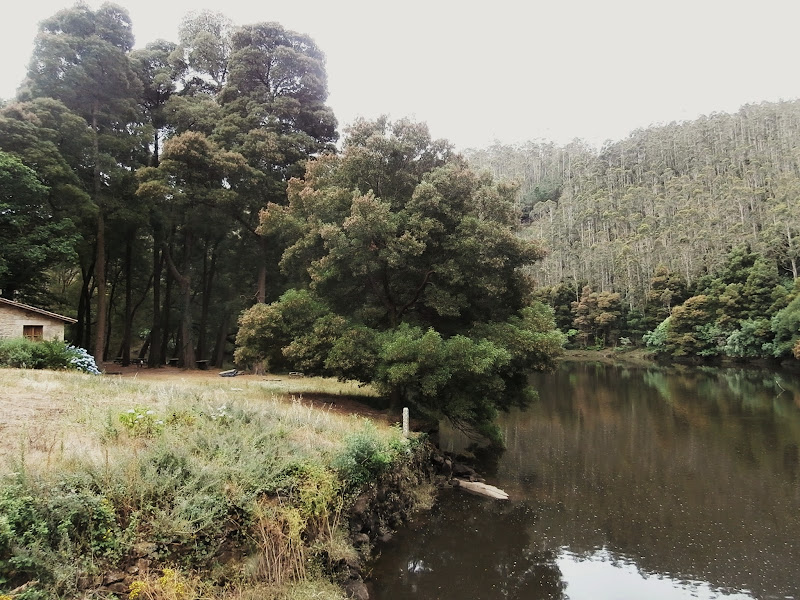
There is a recreational area beside the river.


We leave behind the recreational area. Here we can go to the left, towards the suspension bridge over the river or to the right to start the walk along the footpath beside the river Tambre.

We cross the suspension bridge.

We see the recreational area.

We look upstream from the bridge.

We are getting to the other bank of the river. From here we can take the route towards Ponte Nafonso at the mouth of the river Tambre. There is the bridge built during the reign of King Alfonso I (https://en.wikipedia.org/wiki/Alfonso_I_of_Asturias), although with subsequent changes made in medieval times and also in the 19th century.

We go back and start the pedestrian path that will lead us just over 1 kilometre upstream.


We reach the pesqueira. Now we have to take a narrow path down to the river.

For a long time, in medieval times, a lot of lampreys were fished in the river Tambre (https://en.wikipedia.org/wiki/Lamprey). This type of fish was much appreciated and was an important economic resource for the inhabitants of the area. The construction in the middle of last century of the Barrié de la Maza reservoir, just a few kilometers upstream, has reduced the flow of the river and today lamprey is almost disappeared.
We go down to the pesqueira.


The pesqueira: The lampreys were crossing these rocks going upstream and then they went directly to some fishing nets that were placed there.


We can see from the pesqueira the rapids upstream.

We return to the pedestrian path. A little further on we see a first section of rapids next to the refuge for fishermen.

This is the refuge for fishermen.

We will see an area of rapids, the river is full of large rocks.

Now we are looking downstream from the same point.

The river flows in this part between granite walls. There are wooden walkways in some parts of the path.


After the rapids we see that the river flows placidly.


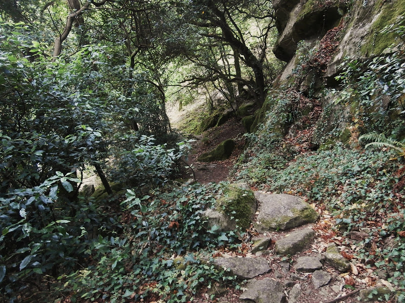
Once we leave behind the wooden walkways the path narrows and becomes more difficult. From here we move into the Devesa de Nimo, beautiful native forest.

Once past this little wooden bridge we start our way back. From here the path continues a few more kilometres. If we continue we will see the Devesa de Nimo, the remains of the Hermitage of San Gregorio, we can even reach the Barrié de la Maza reservoir through the channel of the dam.

We take a last look at the river Tambre before returning to the starting point, with the idea of coming back another time to complete the route.

The End.
I just couldn’t depart your site before suggesting that I actually enjoyed the standard info a person provide for your visitors? Is gonna be back often to check up on new posts https://www.xn--strmtest-74a.no/
ReplyDeleteHello There. I found your blog the use of msn. This is an extremely smartly written article. I’ll be sure to bookmark it and return to read more of your useful info. Thanks for the post. I will definitely comeback. learn this here now
ReplyDelete