Today we visit the Municipality of A Pobra do Caramiñal, on the north bank of the Ría de Arousa, southwest of the province of A Coruña. We will see the Church and Rectory House of Santa María do Xobre.
The church is located in a place of singular beauty, next to the beach O Areal with beautiful views of the beach, the town center of A Pobra do Caramiñal, the port and the Ría de Arousa.
Click Here to see our walk along O Areal beach.

Coordinates to find the location of A Pobra do Caramiñal in Galicia. Extend the map and reach the Church of Santa María do Xobre: 42.596187, -8.929279
We can see to the left the Church of Santa María do Xobre and to the right the Rectory House.

From here we zoom on the marina of A Pobra located at the other end of the beach O Areal. It is 1 kilometre.

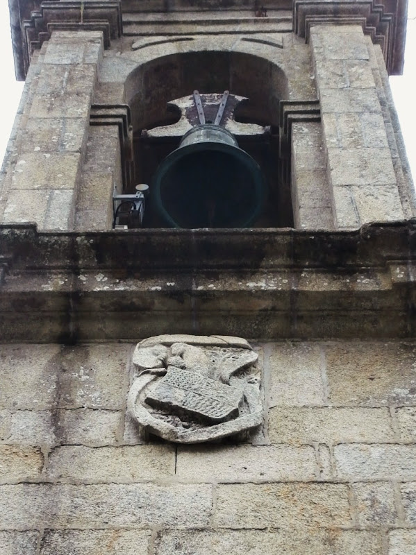
The church was built in the second half of 18th century on the site of an old medieval church. It was built by the Xunqueiras family, whose coat of arms is on the main facade. The bell tower is of a later period.
The Rectory House was also rebuilt in the second half of 18th century highlighting the balcony facing the Ría de Arousa.


This is the main facade of the church which is Baroque. It has a triangular pediment with the coat of arms of the Xunqueiras family under whose initiative the church was built. On both sides we see the statues of Nuestra Señora de la Candelaria and San José.

Coat of arms of the Xunqueiras family.

Statue of San José.

This is a statue of Nuestra Señora de la Candelaria, the patron saint of the parish church.


O Areal Beach and the Ría de Arousa.


The End.
No comments:
Post a Comment