Today we visit the Port of Escarabote. It is part of Lampón which is one of the eight parishes that make up the municipality of Boiro. We are on the north bank of the Ria de Arousa, which belongs to the province of A Coruña. The south bank of the Ría is in the province of Pontevedra.

Coordinates to find the location of Boiro in Galicia. Extend the map and reach the Fishing Port and Marina of Escarabote: 42.636078, -8.902930
Boiro has 19,000 inhabitants. Its economy is based on seafood products mainly mussel cultivation and the entire industry that is around it. Depuradoras (companies dedicated to the process of sanitization of bivalve molluscs), shipyards and canning companies of which one of the most important in Spain and international projection is based here in Boiro.
The two main ports in the municipality are Cabo de Cruz and Escarabote which we will visit today.
The beautiful landscape, the wide variety of beaches and coves as well as its rich architectural, religious and civil heritage make the tourism industry also has great importance in Boiro especially in the summer months.
We cannot forget the imposing presence of the Sierra del Barbanza with oak and pine forests and spectacular views over the Ria de Arousa.
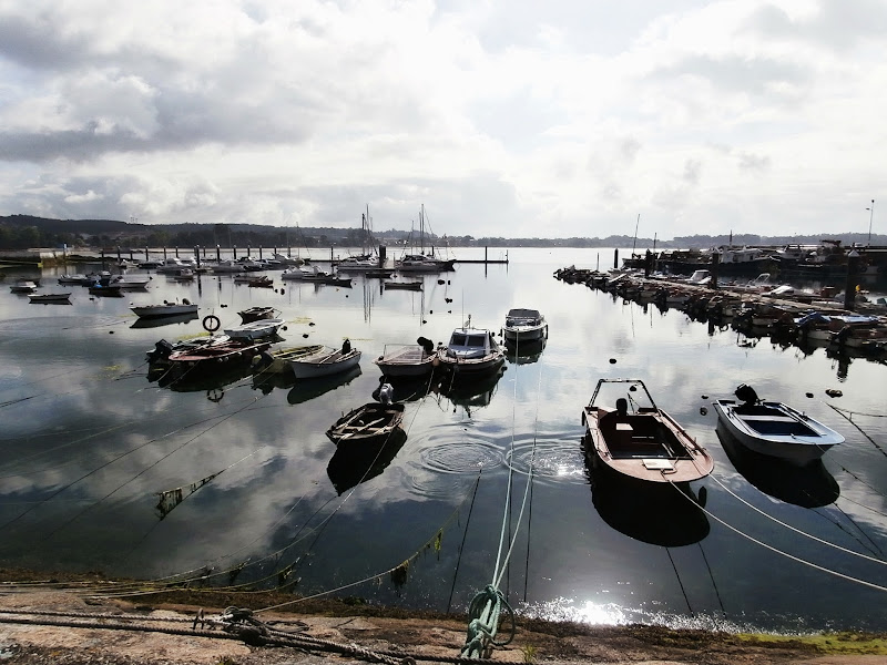
And now we see the fishing port and marina of Escarabote.
By the end of July every year a maritime procession takes place. It is held in honour of the Virgen del Carmen.
We start the walk on the beach Agramuíña.


We are now beside the mouth of the River Coroño which forms an estuary of great beauty. We can see in the background of the picture the Playa Jardín (Garden beach), also called Barraña beach.


And we are now in Punta de Peralto. The facilities of Club Náutico Barraña are here. Cabo de Cruz is seen on the other end of the Ensenada de Boiro. We can also see a marker that warns of the presence of the Aroña Reef.

These are the facilities of the Club Náutico Barraña in the port of Escarabote.

Now we are heading towards the area of the fishing port.


O Porto beach.


This is the pedestrian path of A Magdalena, starts just next to the beach of O Porto. It runs along the coastline to the place of O Conchido.

We see from the footpath the marker that warns of the presence of the Aroña Reef and in the background of the picture the Playa Jardín (Garden beach), also called Barraña beach.


We see from the same point the coast of Boiro, to the right of the picture the place called O Conchido and the Ría de Arousa.

Here ends our first visit to the municipality of Boiro. We will come back, of course.
No comments:
Post a Comment